Not a long drive today from Albuquerque, but the sign says it all:
And it's the 4th of July!!! Fireworks!
On the trip out, we lost 2.5 days in North Little Rock when the fridge died. In order to catch up on our schedule, we left I-40 going out at Santa Rosa, NM and by-passed Albuquerque. Today we passed the spot where we left I-40. Our mileage to this point in the trip: 8,527 miles!
Nothing spectacular along the way unless you count this vehicle that passed us:
Normal truck, right? Not a normal cargo!
We got off I-40 at the first Tucumcari, NM exit so we could see Route 66. We'd been here several years ago and enjoyed all the old motels and the monuments.
Here's the monument done for one of the anniversaries of the Mother Road:
It's a cool monument. A lot of the businesses along the route have neon lights for night, so we're hoping to catch some of the neon tonight. It's the 4th of July and we found out that the fireworks are off the interstate near downtown, so we'll catch the fireworks and the lights!
We need a few groceries and the only grocery store we could find open was Lowe's, so we went in. Lots of different things from what we find at home. We have some new hot chocolate with all the directions and ingredients written in Spanish - Abuelita's. Has a cute little old lady drinking a cup of hot chocolate. Got our groceries and got in the truck. Saw this sign as we were leaving:
We learned later that it reach 105 degrees that day!
Some of the signs we saw that were unusual:
I have others, but won't share what happened with them until the end of the day!
Back to KOA and David's making lunch. We're having tacos or taco salad. He's making it, so it doesn't matter to me! LOL
Nap time so we can stay up late, but I'm not sleepy, so I read/watch TV.
Time for fireworks!
We got directions to a field in town where we could view them. We pulled in and sat next to Mike and Mike..two guys from a nearby town. One of the Mikes had been responsible for the the fireworks show at Ute Lake the night before and he wanted to see this display. It was quite windy, so I don't know how the fireworks will go!
The wind made it difficult to get any really clear shots, but I tried!
On to town! I really wanted to take the Blue Swallow Inn with the neon on. Just as we approached it, they turned out the lights! Used to be the whole Route 66 area was lit at night. Not now, but here are two different signs I did get:
The day version is at the top of the blog!
This one I didn't get a day version of, but did get the neon one:
The Wash Lady!
We were supposed to spend two days here, so I could do more photography at night, but we decided it wasn't worth staying another night for one photo, so we're on to Amarillo, TX tomorrow. We're supposed to meet our friend Donna in Oklahoma City in 2 nights, so we're trying to reach her to let her know we're a day ahead of schedule now.
Late to bed and an early wake up call!
See ya down the road!
Jenny :)
Sunday, July 11, 2010
Saturday, July 3, 2010
Day 48 - Where I almost met my Maker
It rained and stormed during the night, but you cannot tell it. All the moisture was quickly absorbed. Should rain again this afternoon.
One of my online friends, Liz Fraboni, and her family live here in Albuquerque. We decided to meet at Petrogylphs National Monument at 11:00 a..m. We left about 10:15 a.m. because Sir Garmin said it would be about a 30 minute drive. We noticed the sign for the monument the exit before he wanted us to get off I-40. We turned early and followed the signs. I got tired of him telling me "RECALCULATING" that I turned his voice off! We got there about 10 minutes after we left.
We went to the Visitor's Center to wait for Liz. We spent some time outside viewing the plants and exhibits:
Red Sumac
No clue.
The partridge family. Not all the little gray things are rocks. There were 8 or 9 babies here!
We met a Native American woman selling jewelry just outside. She gets her shells from Florida!
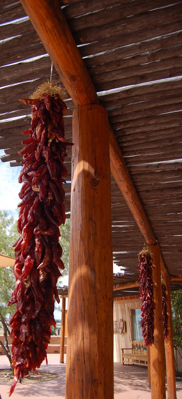
There were lots of strings of chilies hanging outside.
Here's David trying them out!
We went inside the center to look at the displays. The gentleman who talked to us was an older man and seemed very knowledgeable about the area we were going to see. A ranger came in and asked "Dr." if he was ready to leave. Doctor? David asked him what his degree was in. Pediatrics! I made the comment he seemed to have a lot of patience and he laughed. He seemed a little embarrassed by his answer! LOL We thought maybe it was a geology or anthropology degree! It was now after 11:00 a.m. and no Liz. We realized she was probably going straight to the canyon area. I called her and we met her at the canyon area.
Here's the mountain we climbed:
Almost to the top!
We made it!!!! Three really nice Asian guys took our photo for us. They were on an extended trip, too. Have fun guys!
Here's Keely with all of Albuquerque at her feet!
Miss Keely!
Here's what we came to see. The Petroglyphs.
Here's where it gets strange. I thought it would be more difficult to breath. Stopped and took my time. But, I wasn't feeling well. My balance was off and it caused me to stumble a good bit, so David saved me from falling completely down the hill. Then I got to seeing "sparkles" in front of my eyes and it was as bright as it had been and I knew the sun was right overhead. Finally stumbled to the bottom and sat under a covered picnic shed. More water and I felt a lot better. Just thought I wasn't going to make it! I was still a bit wobbly, but okay.
We went to lunch with Liz and Keely at a Chinese restaurant. It was great! First Chinese we've had since leaving home. Still a little wobbly, so I didn't eat all my lunch, but did have plenty of water!
It was time to go....so sad! Liz and Keely had to head home and we had to go by groceries. Liz left and we went to the grocery store in the same parking lot as the restaurant. We didn't buy groceries....the power went out! So.....back to the campground!
They have a lot of old cars and RVs here in the campground. Spent a few minutes taking pictures here:
This one is a Hudson with a teardrop trailer. For more of the photos, visit
http://www.facebook.com/car2nqueen#!/album.php?aid=2002290&id=116600115
Looked like it was going to rain, so everyone took a nap. No rain, just thunder and lightning.
After our nap, David decided to do laundry here at the park. I think I'll keep him!
Trying to decide what's for dinner, looking forward to folding clothes, and getting ready for tomorrow's move. We're off to Tucumcari for a few days on our way home!
See ya down the road!
Jenny :)
One of my online friends, Liz Fraboni, and her family live here in Albuquerque. We decided to meet at Petrogylphs National Monument at 11:00 a..m. We left about 10:15 a.m. because Sir Garmin said it would be about a 30 minute drive. We noticed the sign for the monument the exit before he wanted us to get off I-40. We turned early and followed the signs. I got tired of him telling me "RECALCULATING" that I turned his voice off! We got there about 10 minutes after we left.
We went to the Visitor's Center to wait for Liz. We spent some time outside viewing the plants and exhibits:
Red Sumac
No clue.
The partridge family. Not all the little gray things are rocks. There were 8 or 9 babies here!
We met a Native American woman selling jewelry just outside. She gets her shells from Florida!
There were lots of strings of chilies hanging outside.
Here's David trying them out!
We went inside the center to look at the displays. The gentleman who talked to us was an older man and seemed very knowledgeable about the area we were going to see. A ranger came in and asked "Dr." if he was ready to leave. Doctor? David asked him what his degree was in. Pediatrics! I made the comment he seemed to have a lot of patience and he laughed. He seemed a little embarrassed by his answer! LOL We thought maybe it was a geology or anthropology degree! It was now after 11:00 a.m. and no Liz. We realized she was probably going straight to the canyon area. I called her and we met her at the canyon area.
Here's the mountain we climbed:
Almost to the top!
We made it!!!! Three really nice Asian guys took our photo for us. They were on an extended trip, too. Have fun guys!
Here's Keely with all of Albuquerque at her feet!
Miss Keely!
Here's what we came to see. The Petroglyphs.
Here's where it gets strange. I thought it would be more difficult to breath. Stopped and took my time. But, I wasn't feeling well. My balance was off and it caused me to stumble a good bit, so David saved me from falling completely down the hill. Then I got to seeing "sparkles" in front of my eyes and it was as bright as it had been and I knew the sun was right overhead. Finally stumbled to the bottom and sat under a covered picnic shed. More water and I felt a lot better. Just thought I wasn't going to make it! I was still a bit wobbly, but okay.
We went to lunch with Liz and Keely at a Chinese restaurant. It was great! First Chinese we've had since leaving home. Still a little wobbly, so I didn't eat all my lunch, but did have plenty of water!
It was time to go....so sad! Liz and Keely had to head home and we had to go by groceries. Liz left and we went to the grocery store in the same parking lot as the restaurant. We didn't buy groceries....the power went out! So.....back to the campground!
They have a lot of old cars and RVs here in the campground. Spent a few minutes taking pictures here:
This one is a Hudson with a teardrop trailer. For more of the photos, visit
http://www.facebook.com/car2nqueen#!/album.php?aid=2002290&id=116600115
Looked like it was going to rain, so everyone took a nap. No rain, just thunder and lightning.
After our nap, David decided to do laundry here at the park. I think I'll keep him!
Trying to decide what's for dinner, looking forward to folding clothes, and getting ready for tomorrow's move. We're off to Tucumcari for a few days on our way home!
See ya down the road!
Jenny :)
Day 47 - Our day on the Rez
Got up early to get a head start on the desert and the heat. We actually left an hour earlier than expected and it's a really good thing! The GPS sent us in the wrong direction. We should have been headed to Shiprock, NM instead of climbing to the mountains. We turned around and started toward Shiprock. Couldn't convince Sir Garmin of GPS we were on the right road, so I told him I wanted to go to the Taco Bell in Shiprock. Picked the right road!
We passed this trading post on the way back to Cortez!
One last view of Mesa Verde:
And a shot of the Silver Bean. It's a Cortez coffee shop in an Airstream!
On the road to Shiprock! It's a Navajo Reservation town, but we had to leave the Ute Reservation first.
Then it's New Mexico!
Then it's Shiprock! The name comes from a rock formation in the desert. I wish I could have gotten a better shot, but it's sacred ground there.
One more time in an attempt to confuse Sir Garmin into give us the right road. We were supposed to take Highway 491 to Gallup, NM. If you've even traveled between Shiprock and Gallup, you may not recognize the road number. It used to be Highway 666 or the Devil's Highway. You can read more about this historic road at http://en.wikipedia.org/wiki/U.S._Route_491
It's a long, roller coaster road through the desert. We passed many hogans and many mobile homes with tires on the roof. My brother the roofer says it's to keep the roof on!
We get to Gallup and decided to have lunch at Earl's on Route 66. We've eaten here before and were looking forward to it. I guess everyone else was, too, as we couldn't find a place to park. We drove a little way on Route 66 and found a City Parking Lot, so we pulled in there next to the railroad track. Fixed lunch and then a train went right by the window. It rattle Chrissy a little. Then it started to rain! Didn't see that coming!
Back on the road and Sir Garmin was tricked again into giving us the right directions! We gave him directions to a location on I-40. After that, he knew where our campground was.
We passed through Continental Divide, NM where the elevation is over 7,000'.
We're still in the desert, but we're climbing. It's starting to rain over the desert, too. It looks like a light gray curtain pulled across the landscape. It may look beautiful, but it can cause problems. It's monsoon season and the remnants of Hurricane Alex were pulled up into parts of the western US. When we got to the campground, we learned that a lot of flash flood warnings were up. I'm currently reading "Over the Rim - Death in Grand Canyon." Really paying attention to the flash flood part!
We've stayed at Enchanted Trails RV and Trading Post in the past and like this campground. It's just outside of Albuquerque and easy to get to most places nearby. We visited the office and they suggested some places for dinner. We chose La Hacienda in Old Town. The food was great and our waiter, Matthew, had gone to school in Georgia.
Meeting friends here tomorrow!
See ya down the road!
Jenny :)
We passed this trading post on the way back to Cortez!
One last view of Mesa Verde:
And a shot of the Silver Bean. It's a Cortez coffee shop in an Airstream!
On the road to Shiprock! It's a Navajo Reservation town, but we had to leave the Ute Reservation first.
Then it's New Mexico!
Then it's Shiprock! The name comes from a rock formation in the desert. I wish I could have gotten a better shot, but it's sacred ground there.
One more time in an attempt to confuse Sir Garmin into give us the right road. We were supposed to take Highway 491 to Gallup, NM. If you've even traveled between Shiprock and Gallup, you may not recognize the road number. It used to be Highway 666 or the Devil's Highway. You can read more about this historic road at http://en.wikipedia.org/wiki/U.S._Route_491
It's a long, roller coaster road through the desert. We passed many hogans and many mobile homes with tires on the roof. My brother the roofer says it's to keep the roof on!
We get to Gallup and decided to have lunch at Earl's on Route 66. We've eaten here before and were looking forward to it. I guess everyone else was, too, as we couldn't find a place to park. We drove a little way on Route 66 and found a City Parking Lot, so we pulled in there next to the railroad track. Fixed lunch and then a train went right by the window. It rattle Chrissy a little. Then it started to rain! Didn't see that coming!
Back on the road and Sir Garmin was tricked again into giving us the right directions! We gave him directions to a location on I-40. After that, he knew where our campground was.
We passed through Continental Divide, NM where the elevation is over 7,000'.
We're still in the desert, but we're climbing. It's starting to rain over the desert, too. It looks like a light gray curtain pulled across the landscape. It may look beautiful, but it can cause problems. It's monsoon season and the remnants of Hurricane Alex were pulled up into parts of the western US. When we got to the campground, we learned that a lot of flash flood warnings were up. I'm currently reading "Over the Rim - Death in Grand Canyon." Really paying attention to the flash flood part!
We've stayed at Enchanted Trails RV and Trading Post in the past and like this campground. It's just outside of Albuquerque and easy to get to most places nearby. We visited the office and they suggested some places for dinner. We chose La Hacienda in Old Town. The food was great and our waiter, Matthew, had gone to school in Georgia.
Meeting friends here tomorrow!
See ya down the road!
Jenny :)
Day 46 - Mesa Verde road
What a day! We planned to go to Mesa Verde National Park as they did in the first National Park-to-Park Highway Tour in the 1920's, but we also planned to go to Hovenweep National Monument. Big MISTAKE!
After breakfast we decided we'd go to Hovenweep first. GPS said Cortez, NM and that's where we were so we headed that way. It sent us down some roads that looked like someones driveway! It told us we were there...nothing there but some guys putting in a waterline.
OK, backtrack to town and Highway 160. There is the sign for Hovenweep, so we turn out the road. And we go and we go and we go. I asked the GPS again for directions. Now it tells me it's 88 miles away and in Utah! No, it can't be. Yes, it is. We found out later that it really is in Utah, but has a Cortez, CO address. About 40 minutes into this trip, we turned around. There was no signage to tell you how far it is to the monument. We passed.
We did find another National Monument on this road, though, and it wasn't on my list of National Monuments. It's called Canyon of the Ancients. A lot of it is closed right now for reconstruction, but it looked like a great place to hike--when it's cooler.
About this time I noticed a "portable outhouse" and had a need to go. Here's the name of the company:
Just toooo funny at the moment!
We get back into Cortez and make the obligatory stop at WalMart. It's almost lunch time, and although we're tired of chicken, what did I pickup for lunch? Chicken.
Back to the RV before Mesa Verde and David has fun with his lunch!
At least it was a whole wheat tortilla!
Mesa Verde!
As in most of the National Parks this summer, they, too, have road construction going on. Going up the mountain, there is one section of the road that is paved and the other side is gravel and dirt. One of the lanes is closed and they have a pilot car to take the vehicles on the one lane open.
On our stop up the hill, we met Taleah. She's a charming young woman working the Stop/Slow sign. We asked her if she'd like a bottle of water and we were rewarded with her beautiful smile. She's recovering from a fall in a house where she fell through the fall. She's almost 100%!
Here's what the construction looks like in most parks:
Lovely, huh! I know it needs fixing and they're getting federal funds, but it's discouraging to the visitors. We decided to go as far as the fire station lookout and go back down. We could see gathering clouds on the horizon.
We drove on to the pullout. Here's David and Chrissy. Note the elevation!
We also found beautiful wildflowers here! And lots of interesting trees!
Indian Paintbrush
Lupine
More lupine! The brown part of a building is the rest area here. I hate to admit it, but a bit of poetry came to me:
"When lupine last by the outhouse bloom'd"
With apologies to Walt Whitman.
Orange flower?
OK, enough photos and I didn't put them all in! Back down the mountain!
That road is the one we climbed up. We decided not to go to the cliff ruins. Just too far and late in the day to try and make it down the mountain before the rain hit. But wait...one more picture. That is looking toward Durango, CO.
We make it down safely and head back to Cortez and the KOA. It's a beautiful campground. It's also where we met Kim and Jeff Barnett of Kansas City. They were camping in a pop-up with their two beautiful children. Jeff works for Garmin and I got to see my next Christmas Present. It's a Garmin Nuvi 1370 (I think that's it). It shows the terrain in 3D. That is something I've been interested in for some time. It would have been very helpful. We really enjoyed meeting them!
Most of you know I have a really warped sense of humor. Here's the welcome sign to Cortez:
It's just outside the Cortez Cemetery.
What's on the other side of the sign?
It faces the cemetery! It just struck me as terribly funny!
Tomorrow we're off to Albuquerque, NM!
See ya down the road!
Jenny :)
After breakfast we decided we'd go to Hovenweep first. GPS said Cortez, NM and that's where we were so we headed that way. It sent us down some roads that looked like someones driveway! It told us we were there...nothing there but some guys putting in a waterline.
OK, backtrack to town and Highway 160. There is the sign for Hovenweep, so we turn out the road. And we go and we go and we go. I asked the GPS again for directions. Now it tells me it's 88 miles away and in Utah! No, it can't be. Yes, it is. We found out later that it really is in Utah, but has a Cortez, CO address. About 40 minutes into this trip, we turned around. There was no signage to tell you how far it is to the monument. We passed.
We did find another National Monument on this road, though, and it wasn't on my list of National Monuments. It's called Canyon of the Ancients. A lot of it is closed right now for reconstruction, but it looked like a great place to hike--when it's cooler.
About this time I noticed a "portable outhouse" and had a need to go. Here's the name of the company:
Just toooo funny at the moment!
We get back into Cortez and make the obligatory stop at WalMart. It's almost lunch time, and although we're tired of chicken, what did I pickup for lunch? Chicken.
Back to the RV before Mesa Verde and David has fun with his lunch!
At least it was a whole wheat tortilla!
Mesa Verde!
As in most of the National Parks this summer, they, too, have road construction going on. Going up the mountain, there is one section of the road that is paved and the other side is gravel and dirt. One of the lanes is closed and they have a pilot car to take the vehicles on the one lane open.
On our stop up the hill, we met Taleah. She's a charming young woman working the Stop/Slow sign. We asked her if she'd like a bottle of water and we were rewarded with her beautiful smile. She's recovering from a fall in a house where she fell through the fall. She's almost 100%!
Here's what the construction looks like in most parks:
Lovely, huh! I know it needs fixing and they're getting federal funds, but it's discouraging to the visitors. We decided to go as far as the fire station lookout and go back down. We could see gathering clouds on the horizon.
We drove on to the pullout. Here's David and Chrissy. Note the elevation!
We also found beautiful wildflowers here! And lots of interesting trees!
Indian Paintbrush
Lupine
More lupine! The brown part of a building is the rest area here. I hate to admit it, but a bit of poetry came to me:
"When lupine last by the outhouse bloom'd"
With apologies to Walt Whitman.
Orange flower?
OK, enough photos and I didn't put them all in! Back down the mountain!
That road is the one we climbed up. We decided not to go to the cliff ruins. Just too far and late in the day to try and make it down the mountain before the rain hit. But wait...one more picture. That is looking toward Durango, CO.
We make it down safely and head back to Cortez and the KOA. It's a beautiful campground. It's also where we met Kim and Jeff Barnett of Kansas City. They were camping in a pop-up with their two beautiful children. Jeff works for Garmin and I got to see my next Christmas Present. It's a Garmin Nuvi 1370 (I think that's it). It shows the terrain in 3D. That is something I've been interested in for some time. It would have been very helpful. We really enjoyed meeting them!
Most of you know I have a really warped sense of humor. Here's the welcome sign to Cortez:
It's just outside the Cortez Cemetery.
What's on the other side of the sign?
It faces the cemetery! It just struck me as terribly funny!
Tomorrow we're off to Albuquerque, NM!
See ya down the road!
Jenny :)
Subscribe to:
Posts (Atom)


